Statewide Geospatial Data for Arizona's GIS Operations
See how Ecopia AI can scale statewide geospatial data creation for Arizona to support strategic initiatives related to extreme heat, sustainability, drought monitoring, pedestrian safety, and more.
Leverage the power of AI to scale GIS data creation across Arizona
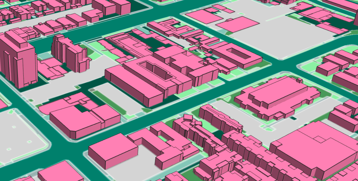
Ecopia's AI-based mapping systems ingest satellite, aerial, and street-view imagery to extract high-precision vector maps in a fraction of the time it takes to manually digitize features. The result? Comprehensive, accurate, and up-to-date geospatial data that Arizona's GIS professionals can use for strategic decision-making.
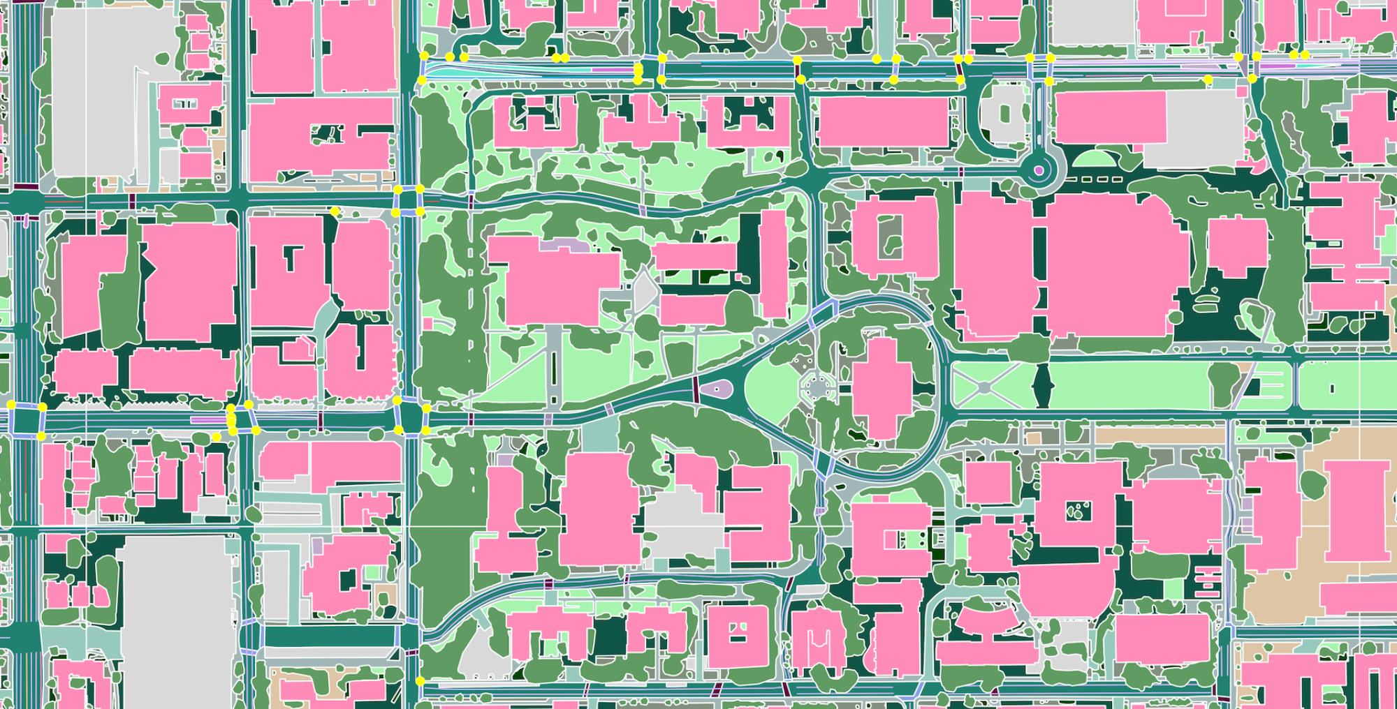
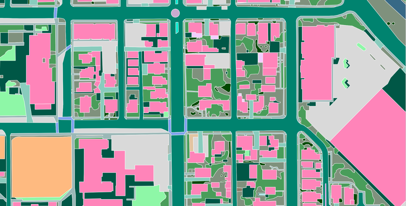
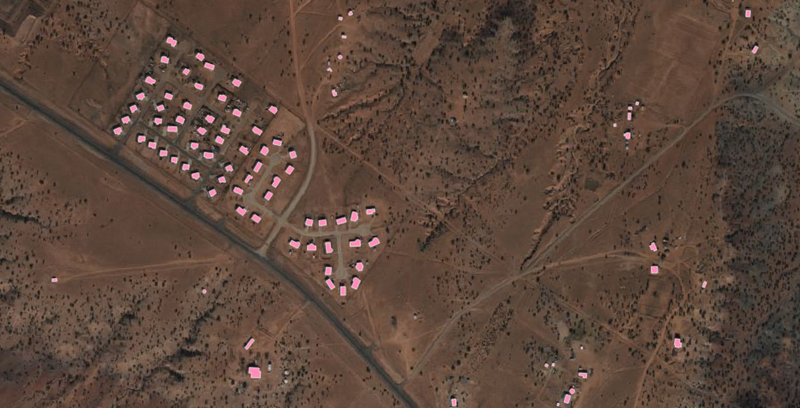
Check out this sample of data from Tucson and imagine what a statewide database could enable Arizona's agencies to accomplish.
High-precision data to support Arizona's top priorities & decision-makers
Understand how existing land cover and infrastructure impacts pressing climate issues related to extreme heat, droughts, and similar hazards in order to inform resilience strategies and mitigation efforts.
Analyze highly detailed transportation features to support pedestrian right-of-way analysis, multimodal network planning, Vision Zero goals, ADA compliance, and more.
Confidently identify all broadband-serviceable locations and expand coverage to all residents, ensuring no community is left behind.

Provide Arizona's state agencies, MPOs, and municipalities with authoritative GIS data to foster a statewide environment of geospatial innovation.
Ecopia data is currently in use by GIOs, climate resilience officers, GIS administrators and directors, natural resource managers, hazard mitigation and disaster management professionals, and other state stakeholders to better understand the intersection between society and our environment.
Ecopia works with hundreds of US government organizations to scale geospatial data creation and support GIS workflows related to climate resilience, transportation planning, sustainability, change detection, and more.
cost savings mapping impervious surfaces in Jacksonville
scale increase mapping transportation features in San Bernardino County
Trusted by leading public sector organizations
See what geospatial professionals have to say about Ecopia
High-resolution land cover data is an integral part of understanding the relationship between the population and our planet, and provides an essential foundation to a wide range of geospatial analytics for climate resilience, sustainability, and other key initiatives.

IDOT is excited to provide resources to metropolitan planning organizations with an innovative data tool for critical statewide infrastructure.

The ability for planners in urban, suburban, and rural areas to access this critical, up-to-date information about our existing infrastructure and communities will help them to develop even better data-driven plans for enhancing sustainability, mobility, and livability as the landscape changes.

Ecopia’s data is the most complete record of addresses and buildings for Arizona, allowing the State to submit location-based challenges to the FCC to secure funding for broadband expansion.

I cannot emphasize enough how much time Ecopia saves us. It took four years to build our previous dataset which quickly became stale and needed updating. Each year, Ecopia is able to extract the features we need in just a few weeks, ensuring we always have a fresh database for emergency response planning.

We needed accurate and complete data to effectively allocate taxpayer dollars to transportation infrastructure improvements. Ecopia was the only data company we found that could deliver the exact features we were looking for at the level of quality we require to justify funding our projects.

State spotlight: Washington
Ecopia developed a high-precision land cover map for the State of Washington to support climate resilience and sustainability initiatives, providing authoritative data across the state's 71,429 square mile area in just 4 weeks.
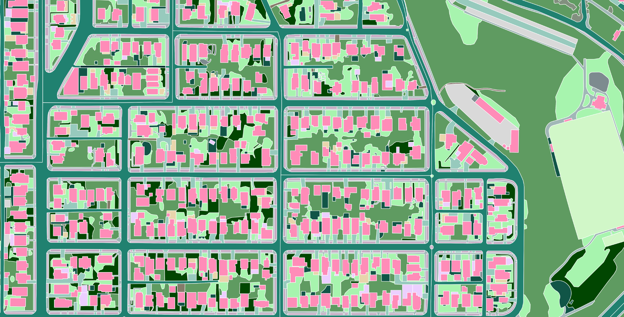
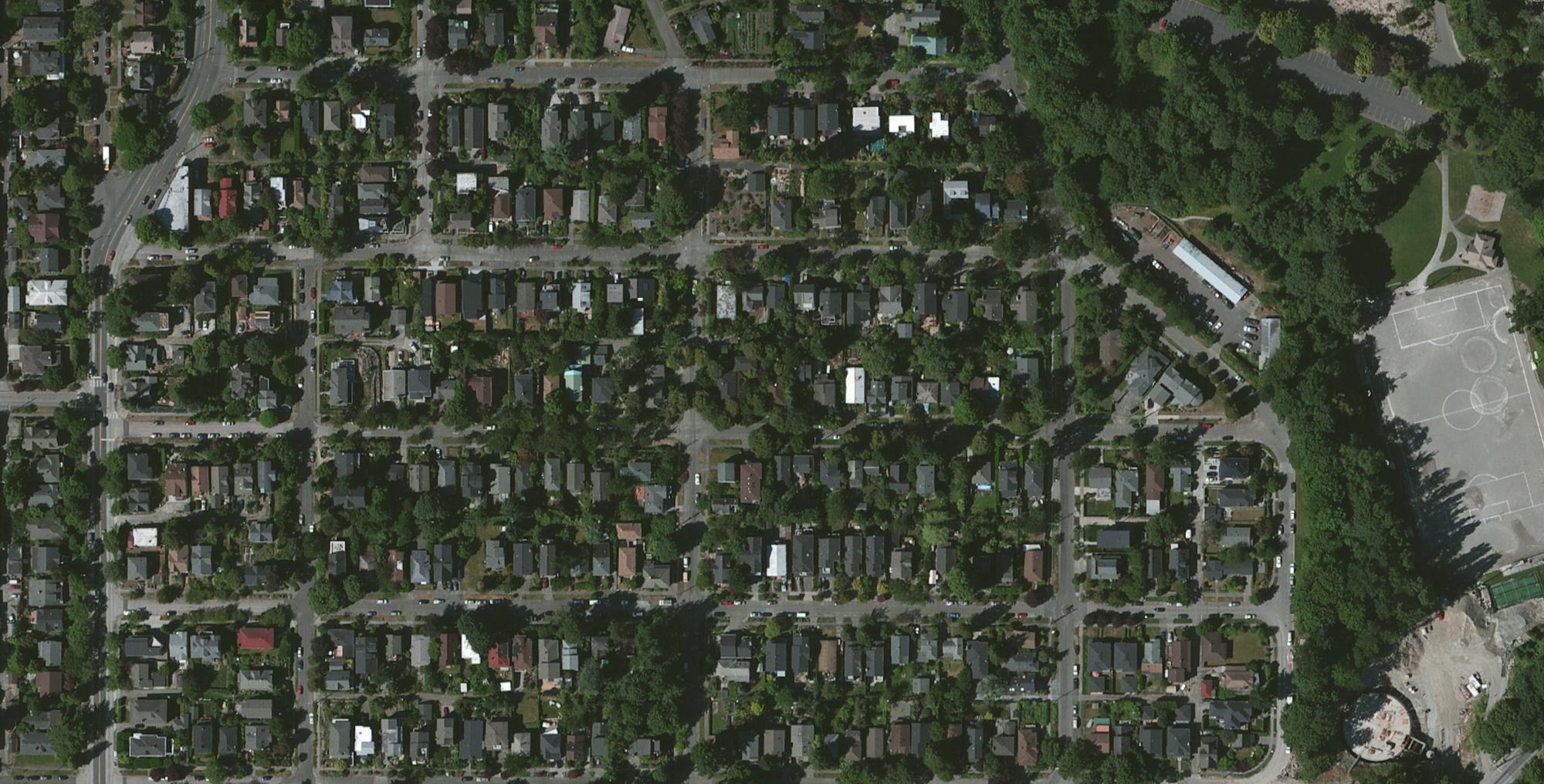
Check out this example of Ecopia's comprehensive, accurate, and up-to-date land cover in Seattle, Washington.
See how Ecopia is already empowering geospatial innovation in Arizona
-
Arizona secures ~$1B in federal funding for broadband expansion
Ecopia and Dewberry worked with the State of Arizona to produce a comprehensive map of buildings across its entire 113,900 square mile area, identifying broadband-serviceable locations and ultimately resulting in almost $1B in federal funding to expand internet access to all communities.
-
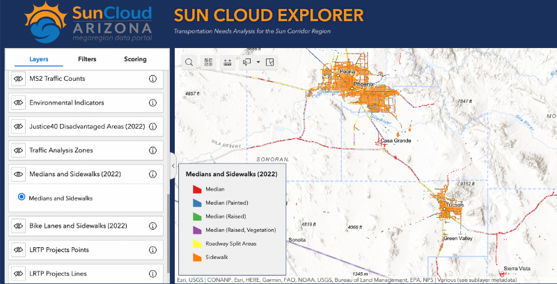
Ecopia data powers transportation planning in the Sun Corridor megaregion
The five counties of the Sun Corridor have embedded Ecopia data into a collaborative open data portal, providing communities with access to standardized information to promote equity, safety, active mobility, and more.